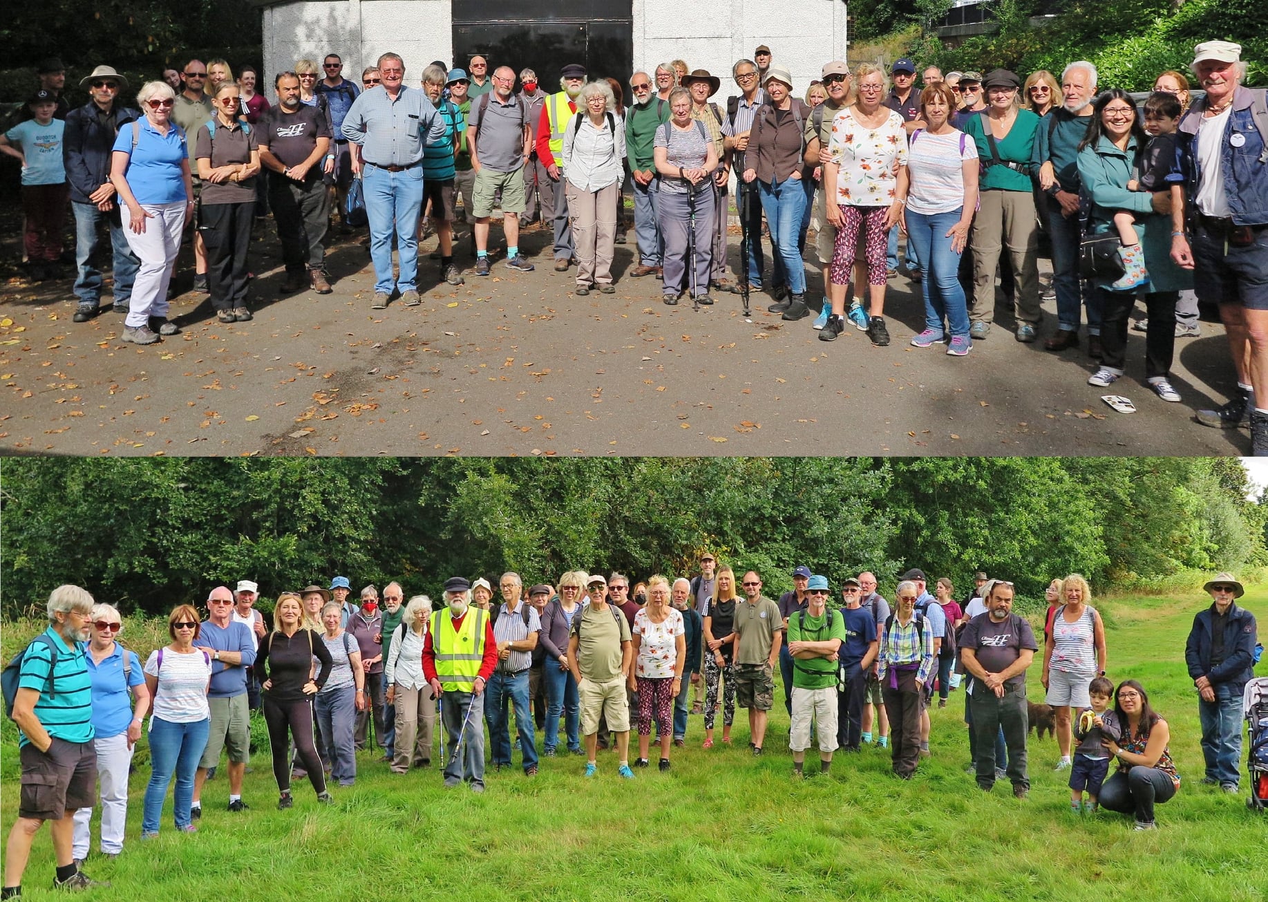
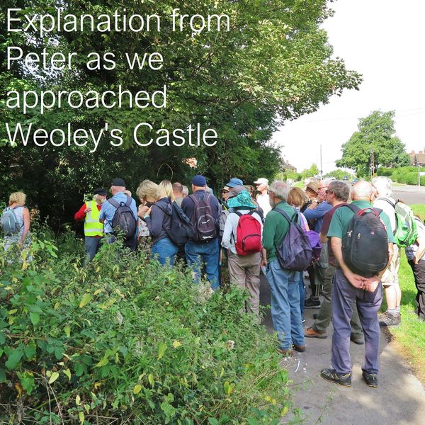
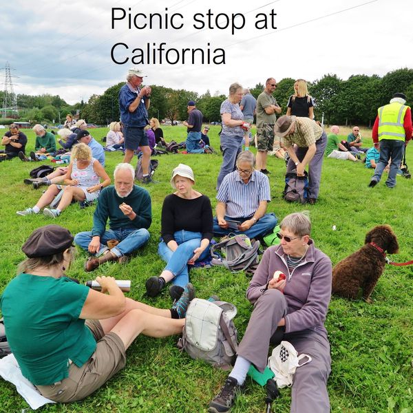
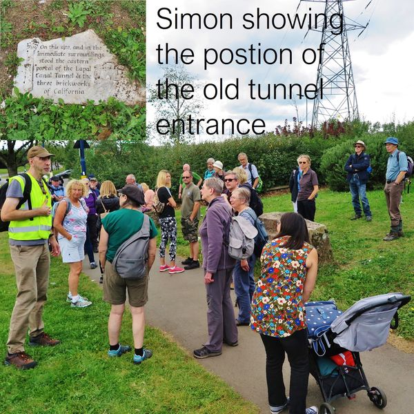
Restoration Plan: Lapal East; Phase-2


EP2 The Lodge Hill Section [LELH] :

This 1273yds (1164m) long section includes the two sub-sections designated Lodge Hill - East and Lodge Hill - West, and has been identified as the Phase-2 restoration project.

EP 2.1 Lodge Hill East [LE4] :

The Lodge Hill East section is flanked by the rear gardens of properties continuing along Reservoir Road (north side) and is also flanked on the south side, by the properties in Corisande Road. The channel in the back land between, is infilled though not to full water level in all places, and the Castle Walkway meanders approximately along the midline. The original towpath (north side) is unused and overgrown.

For consistency with the main Selly Oak Park section (LE3), the former north-side towpath line would not be reinstated, to provide the Reservoir Road properties with a "security moat" (with a hard edge). Conversely, on the south side, the properties in Corisande Road have rear-garden garages that are connected by a vehicle-width lane and several access alley-ways between the houses. It is suggested that appropriate landscaping would retain this lane (at its 'high' level) with a new towpath being formed 'below' it (also with a hard edge). Appropriate landscaping would allow for fencing (renewed and more substantial) to separate the vehicle lane from the towpath, and additional barrier gates that only permit access for the residents' vehicles. Formal but narrow gaps in that fencing will be required to offer pedestrian access from the alley-ways to the towpath (with sloping profiles that are friendly to prams and pedal cycles). This arrangement would improve the resident's access to their garages while also providing additional security against unwelcome vehicles. In places, the difference in levels may require a brick wall to retain the vehicle access lane with the renewed fencing acting as its safety barrier.

An MEB sub-station on the south side, approximately 70 yds from the boundary of Selly Oak Park, adjoins the vehicle lane and the cut, and may need re-siting (unless it is alongside the old narrows).

An alley from Reservoir Road (between 189 & 191) will require public right-of-way access across the canal to the new south-side towpath. An accommodation swing bridge [LE4S] is proposed for this; being normally closed and temporarily opened by vessels as they pass.

EP 2.2 Lodge Hill Crossing [LE4B, LE5A] :

The two Lodge Hill back land sections are presently separated by a tarmac footpath. It provides a diagonal crossing between two alleys, approximately 55 yds apart, linking Corisande Road (opposite Weoley Avenue) with Nuteley Grove (between 23 & 25). This right-of-way could be sympathetically preserved with a roving bridge having gradual inclines ("wheel access") rising from the towpath and acess alley-way, on the south-east side, descending to the north-west side. From there, the Castle Walkway would resort to the former north-side towpath to be reinstated along the Lodge Hill West [LE5] section to meet another alley from Reservoir Road (between 315 & 317), approximately 85 yds away .

As the canal passes beneath this bridge, the bridge hole might be designed as a stop-plank or stop-lock narrows, as another real and visible provision to isolate the two sections, particularly in view of the proximity of the Stonehouse Brook [at LE5B].

EP 2.3 Lodge Hill West [LE5] :

As noted above, this is the section where it is feasible for the original, north-side towpath to be reinstated, along the backland of the Reservoir Road and then Burnel Road properties. The channel in this section (much like section LE4) is substantially infilled to obscure the exact line of the cut, but the present footpath appears to meander along the midline and many of these nearside properties have additional backland between them and the canal. Some sympathetic landscaping, tree and shrubbery management, and the removal of refuse and debris would greatly enhance the aspect hereabouts.

EP 2.3.1 Interim Terminus

At the intersection of the canal with Stonehouse Brook, a pedestrian bridge crosses the culvert close to the Burnel Road properties. In this general vicinity, the rear gardens of the Alwold Road (south side) properties are set back from the canal; being flanked by a vehicle-access lane and the up-stream culvert of the Brook. Hence the canal's infill and the adjoining backland, on both sides of the Brook, form a triangle which is much more spacious than in the immediately preceding sub-section.

As noted in the overview Plan, the invert of the Brook approximately coincides with the invert of the cut, to offer two principal possibilities here. Either;

  1. lower the invert to a duct under the canal, as in former times, or
  2. arrange for the Brook to enter the canal (south side) as a water source, and provide an excess-water out-flow weir (under the north-side towpath) into the present down-stream culvert.

The latter arrangement yields several possibilities one of which could be the inclusion of a winding hole [LE5B] for this to become the far-end navigable reach of the Phase-2 restoration. Given the additional backland area, there is, in principle, enough space for some imaginative landscaping (of the entire triangle) to provide a small mooring and picnic area, to create a pleasant interim terminus. Furthermore, if the up-stream culvert of the Brook is assimilated into the canal as far west as Bottetourt Road (the base of the triangle), a small basin could be achieved to serve as a Boaters' access to the Weoley Castle ruins, approximately 200 yds away. Once the entire Lapal Canal becomes re-opened to full navigation, this winding/basin ("The Castle Basin") would be retained as the 'lay-by' for vessels preparing for (or resting after) their journey through the Lapal Tunnel. Such restoration and development would add to the ambience and significance of this District.
(It will be necessary to clarify land-ownership issues hereabouts, particularly for the property whose foundations remain in the south-west inset of this triangle.)

EP 2.3.2 Interim Water Supply

If the substantial funding requirements for the full Phase-2 restoration project are unlikely to be realised for several years, following Phase-1 restoration, consideration might be given to an interim measure to divert (some of) the Stonehouse Brook water. One possibility might be to provide an open culvert as a water feature which meanders approximately alongside the Castle Walkway. This would make it a narrow and shallow stream, perhaps with occasional small ponds and simple bridges, here and there. These would add interest and encourage aquatic fowl and wildlife to form habitats.

Such work could be undertaken by a Youth Opportunities Scheme (as had been the creation of ponds in Harborne Wharf, in the 70's). However (unlike the Harborne Wharf scheme) it should be accompanied by a commitment to annual maintenance and not allowed to become overgrown in the subsequent years of its temporary existence.

Strategy Plan Phase-1 Phase-2 Phase-3
    Parkland Backland Meander Heritage Flank
Western Approach Canal :  West West Hawne Basin / Leasowes Park Abbeyfields St Mary's
Eastern Approach Canal :  East East Battery Park / Selly Oak Park Lodge Hill Weoley Castle